

I grew up in British Columbia, and the Fraser River has always been part of the backdrop of my life. It’s the river I followed on road trips to the interior, the one with the biggest title on the maps in my classrooms, the mighty Fraser that connects the province.
Like many people who grew up here, I learned about the Fraser River mostly as geography—an important river that shaped trade, settlement, and development of the province. But during a recent field trip with a Grade 4 class to Salishan Place by the River in Fort Langley, I found myself learning more of its story alongside the students.
Salishan Place by the River is the new home of the Fort Langley Library and Museum. It hasn’t opened to the public yet, but school groups like Mika’s class are among the first visitors to step inside. In the main gallery space, a single vintage truck sat on display. Otherwise, the room was empty—no exhibits, no artwork on the walls, no shelves of books.
Instead of wandering through displays, the class was guided into a classroom space just off the gallery. Inside were eight tables, a few screens mounted on the walls, and cabinets along the back. It looked more like a workshop than a museum exhibit, but it was exactly the kind of space needed for the learning that followed.
The Colonization of the Fraser River
Our facilitator, Alex, introduced the session: The Colonization of the Fraser River. He began with a conversation about the Fraser Valley and the Nations whose territories are included in the region: Kwantlen, Katzie, Matsqui, and Semiahmoo.
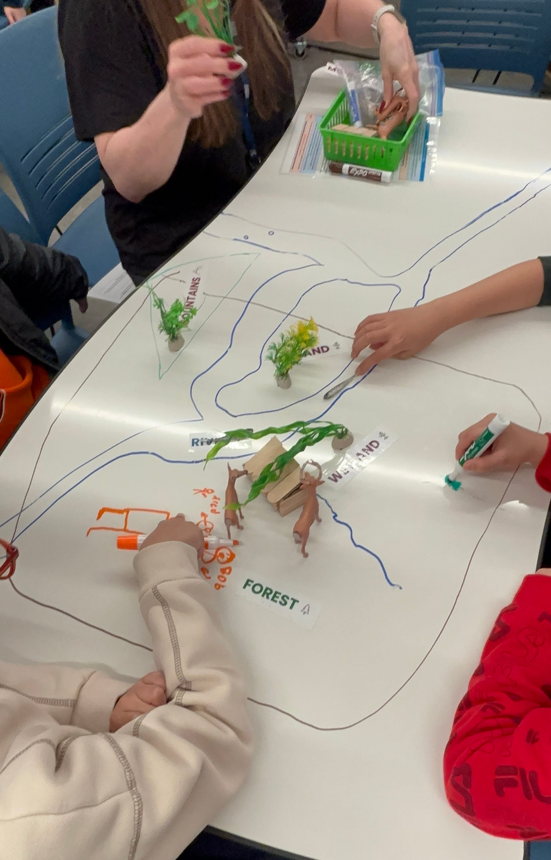
Students were divided into table groups, each supported by a museum docent. The tables themselves worked like giant whiteboards, allowing students to draw directly on them.
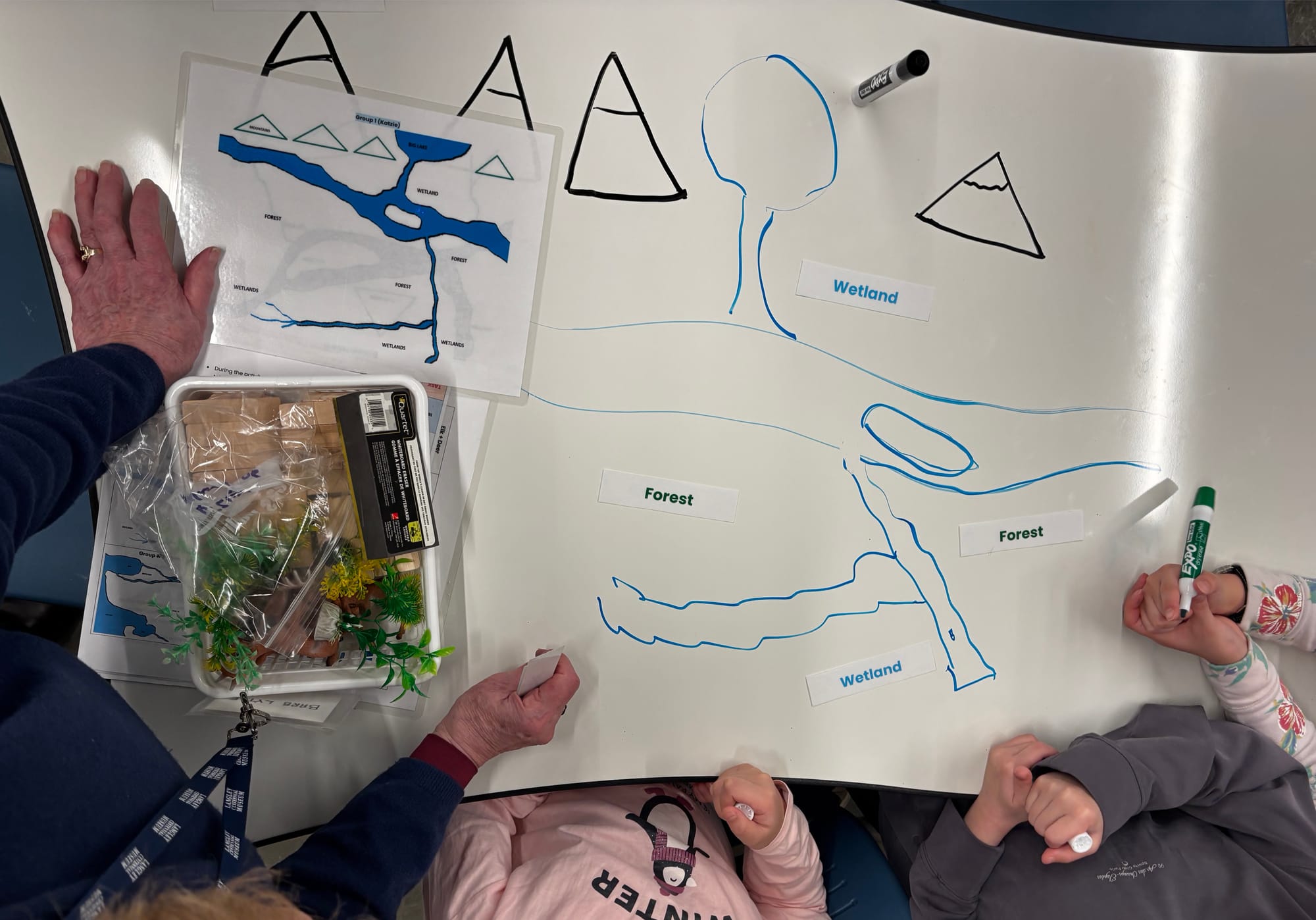
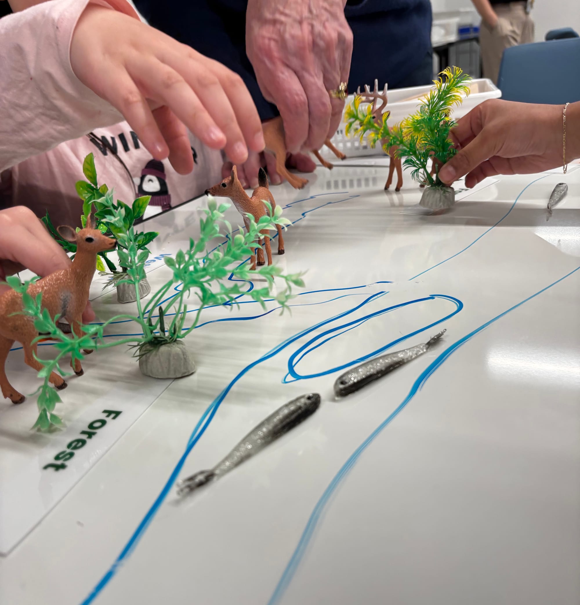
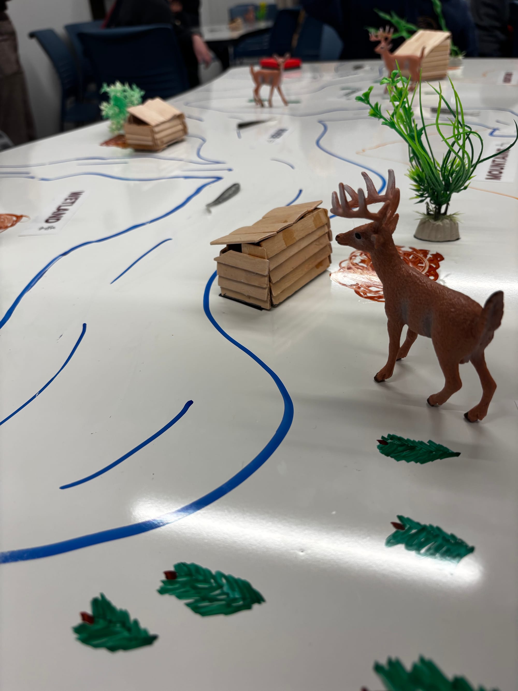
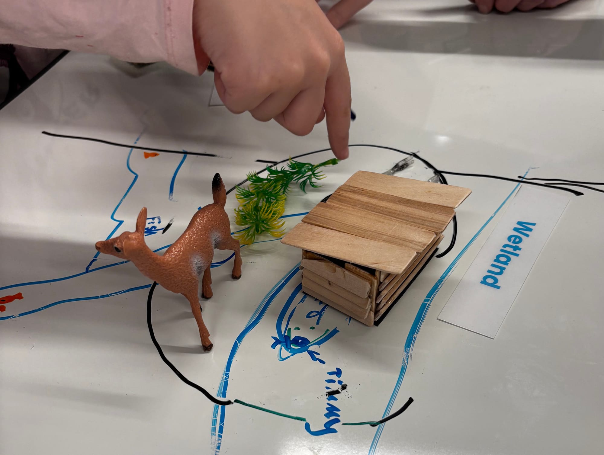
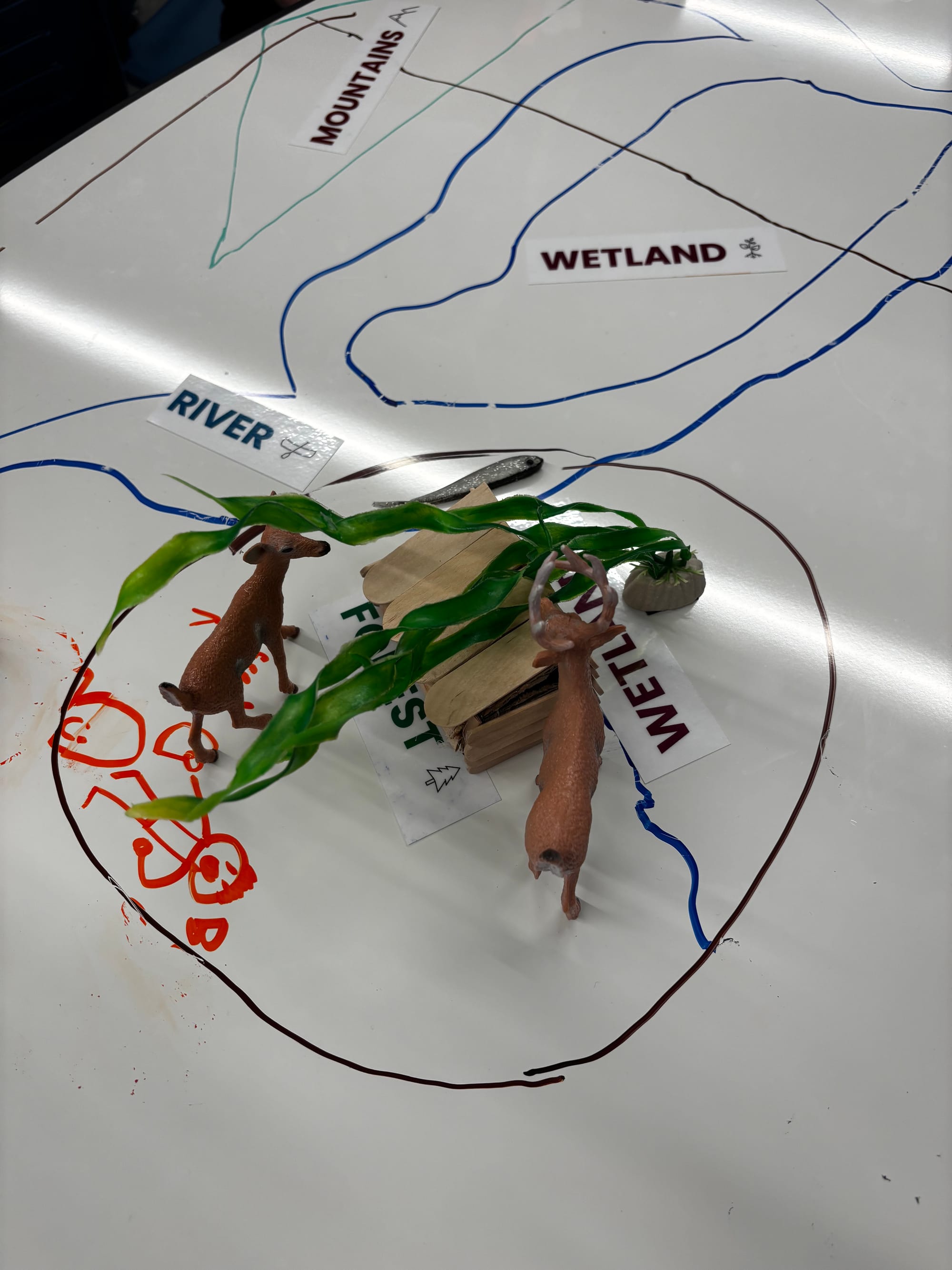
On each table, students drew a section of the Fraser Valley. Rivers, mountains, wetlands, and forests appeared across the surface. Toy deer and fish marked hunting and fishing areas, while small longhouses represented villages. The exercise quickly became a conversation about geography and survival.
Where would a village make the most sense? Close to the river? Near the mountains? Somewhere that offered both food and protection? Students began thinking about the land as a system of resources and relationships.
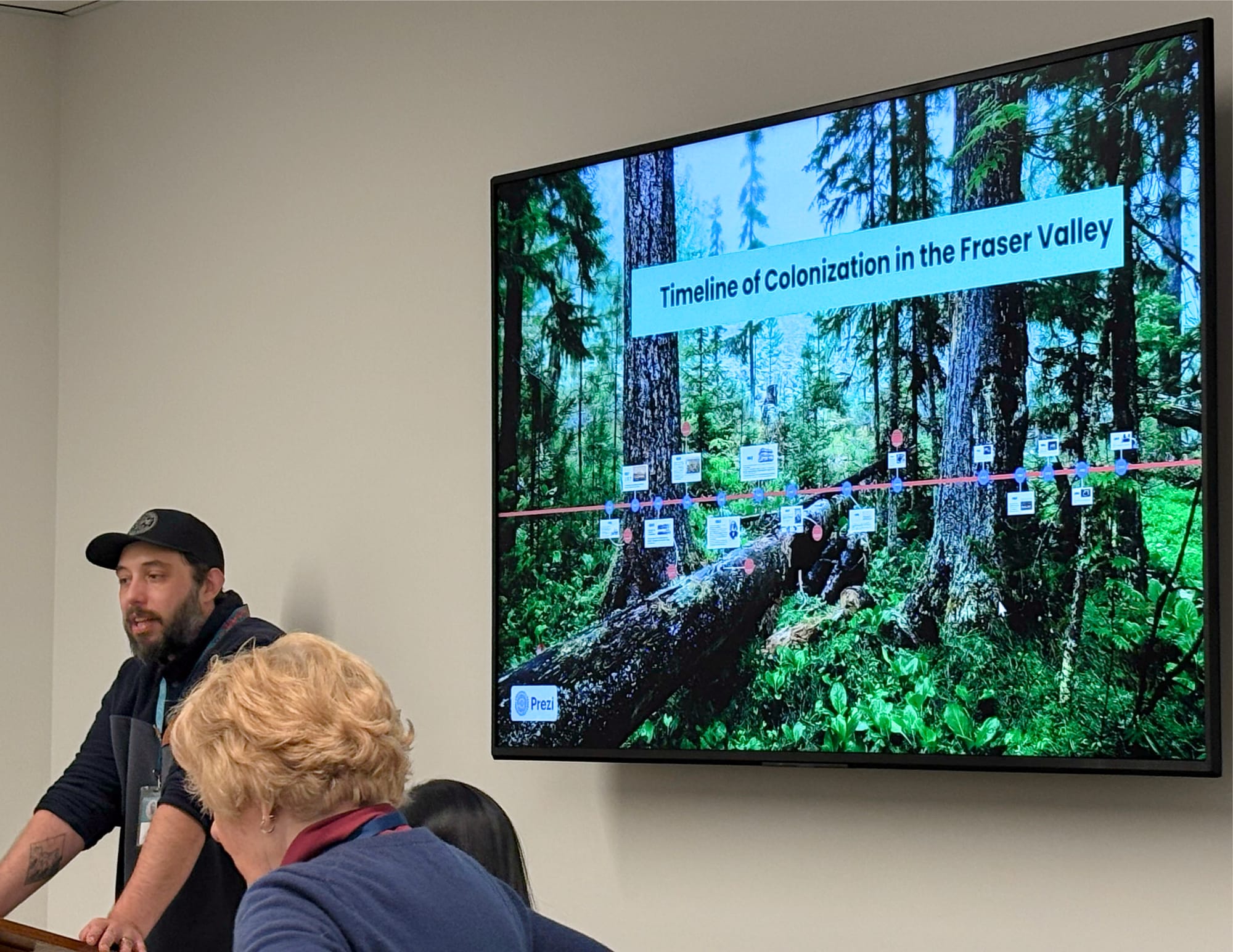
Alex then presented a timeline of the colonization of the Fraser Valley. As key moments in Indigenous and Canadian history were introduced (first contact, colonial policies, treaties, the creation of reserves, and residential schools) students were asked to adjust their maps.
When half of the Indigenous population was decimated because of diseases introduced by European settlers, students had to remove half of the villages from the map. With the introduction of the Indian Act of 1867, more villages disappeared. Resources shifted and boundaries were redrawn. Students removed wetlands and animals from the tables. Hunting grounds, fishing areas and living spaces were literally erased from their maps.
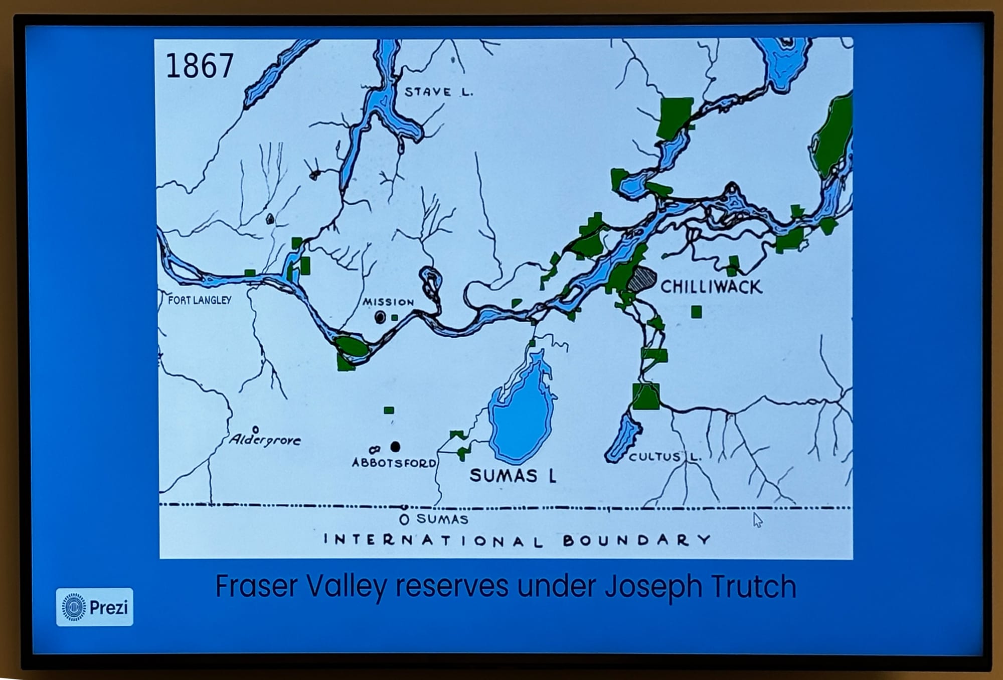
Redrawn borders and restricted land use.
Each change required discussion. Students debated which areas mattered most and what they could—and could not—afford to lose. What started as a simple map became a series of difficult choices.
At the end of the timeline activity, Alex asked the students how they felt about the redrawn map they had created. I heard students say things like “confused, angry, shocked, sad.” The realization sat heavy in the room. Alex acknowledged the feelings and shared how important it is for Canadians not to leave these stories in the past.
Alex connected what the students had just mapped to the ongoing work of healing — Truth and Reconciliation, the Commission's 94 calls to action, Orange Shirt Day on September 30. These weren't distant classroom ideas anymore, they had traveled to the Fraser River to hear the story of its people, standing on the same shore.
Connecting to Reconciliation
The session concluded with a discussion about the Bentwood Box, created for the Truth and Reconciliation Commission in 2009. As the box travelled across Canada, people placed personal items inside to represent stories, memories, and commitments to healing.
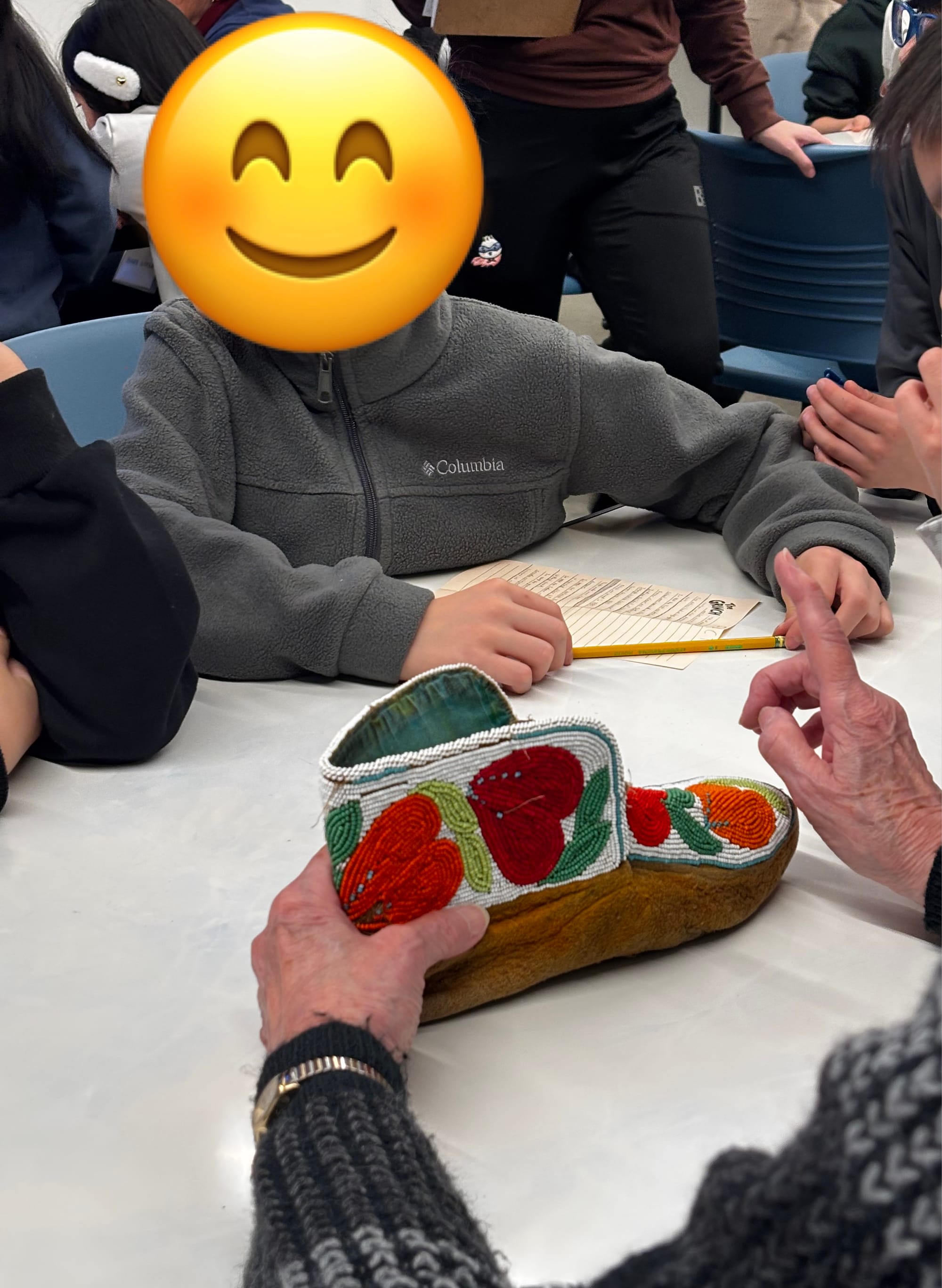
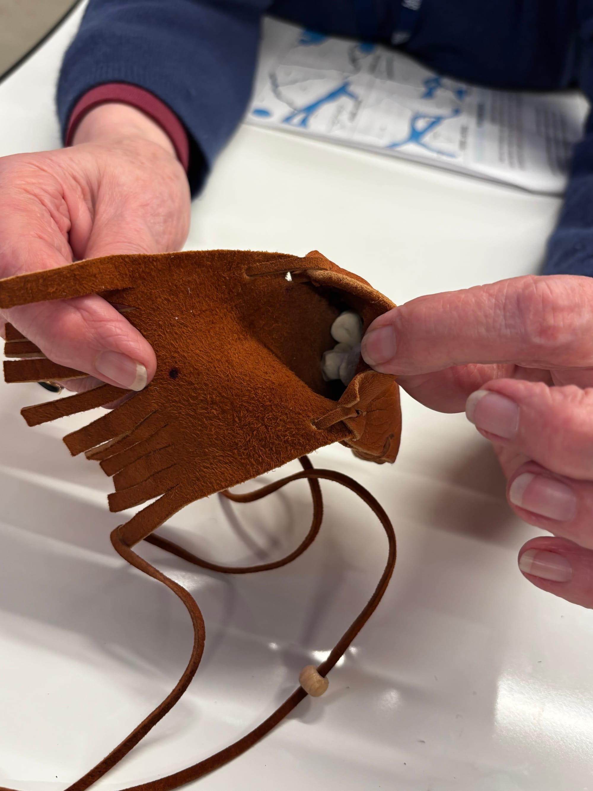
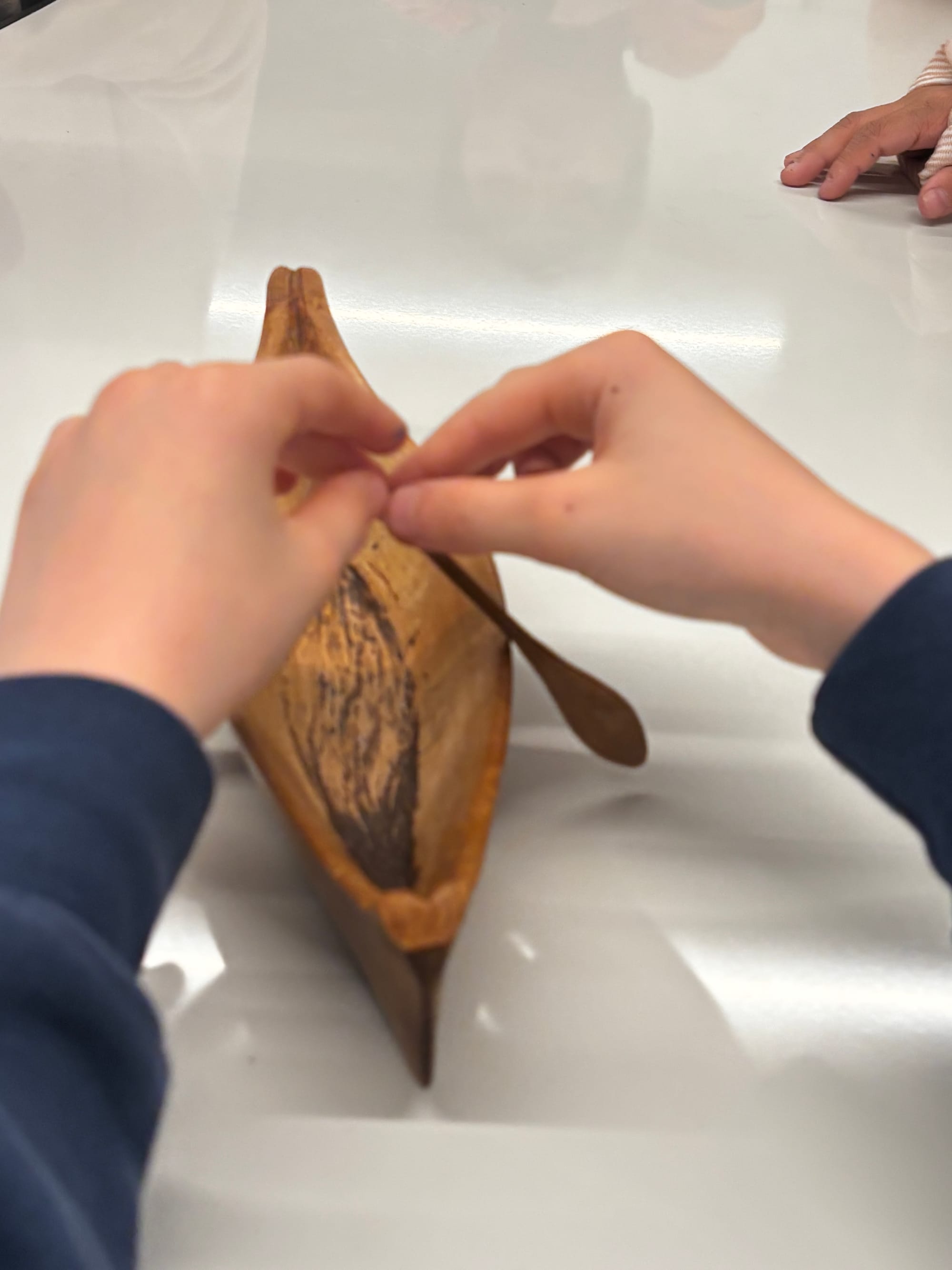
Replica items from the Bentwood Box
Students examined replicas of some of those items—moccasins, a carved canoe, a medicine pouch, an arrow, and letters of apology from churches that had operated residential schools.
The artifacts connected the historical timeline to something more personal, showing that reconciliation is an ongoing process rather than a closed chapter.
After the session, the class walked a few blocks to a small pier overlooking the Fraser River. Standing there with the students, I could see how the landscape from the maps was visible beyond the classroom.
The entire experience at Salishan Place by the River was thoughtfully designed and scaffolded for the age of the students. It was also incredibly relevant for the grown-ups in the room. A big thank you to the programmers Alex and Mackenzie, and all the docents who supported the learning experience. And thank you, Mika for booking the trip and bringing me along.
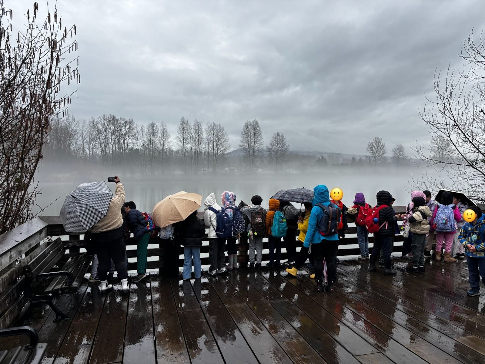
The Fraser River has long been a pathway connecting First Nations communities to each other and to the land around them. I’ve known this river most of my life, and over the years, I’ve come to understand it as more than just a body of water to cross. Learning experiences like this add new layers of understanding, if we’re open to them. Watching the students connect to its history, it felt like a reminder that the same river continues to connect all of us who live in this province today.
Mika's Reflection
Our host teacher, Mika, shares her thoughts about the field trip.
With it being my first year of exploring the Grade 4 curriculum, I felt some apprehension about how best to cover complex topics such as the colonization of Canada. I was cognizant of wanting to integrate different perspectives to encourage critical thinking, but also to celebrate Indigenous knowledge and culture. It was also important to consider Truth and Reconciliation and the steps that are being taken. In our recent classroom readings and discussions, students have been exposed to different perspectives as we learned about historical timelines, first contact with Europeans, and the growth of the fur trade.
Our workshop experience at Salishan Place further built on the ideas that we had been discussing - quite organically. By drawing out maps of the area, a visual element was added, making the learning both more tangible and visible. Each time a change that impacted the Indigenous communities was introduced, it was done so in a way that the students could easily understand and resonate with. It was an impactful and meaningful field trip that led to some really reflective thinking afterwards, but also a lasting awareness of the history of our local community.