

What Does the Island Look Like?
In the book The Wild Robot, the main character Roz crash lands and awakens on an unknown island. But what does that island actually look like?”
That was the question Libby’s Grade 3 students explored as they reached the end of Peter Brown’s novel.
Setting Up the Lesson 🏗️
Earlier in the term, they had completed a Science unit on landforms found in British Columbia, learning to identify mountains, plateaus, valleys, riverbeds, and beaches. Now it was time to use that knowledge in a completely different context.
While Roz’s adventure unfolded, we realized the novel offered something unexpected: a chance to put that scientific understanding to work in the context of the story. We asked the students:
“The Wild Robot is set on an island. But what does that island actually look like?”
Libby had a plan to blend the learning areas into a fun, cross curricular project, blending science, language arts, and some surprise introduction to coding.
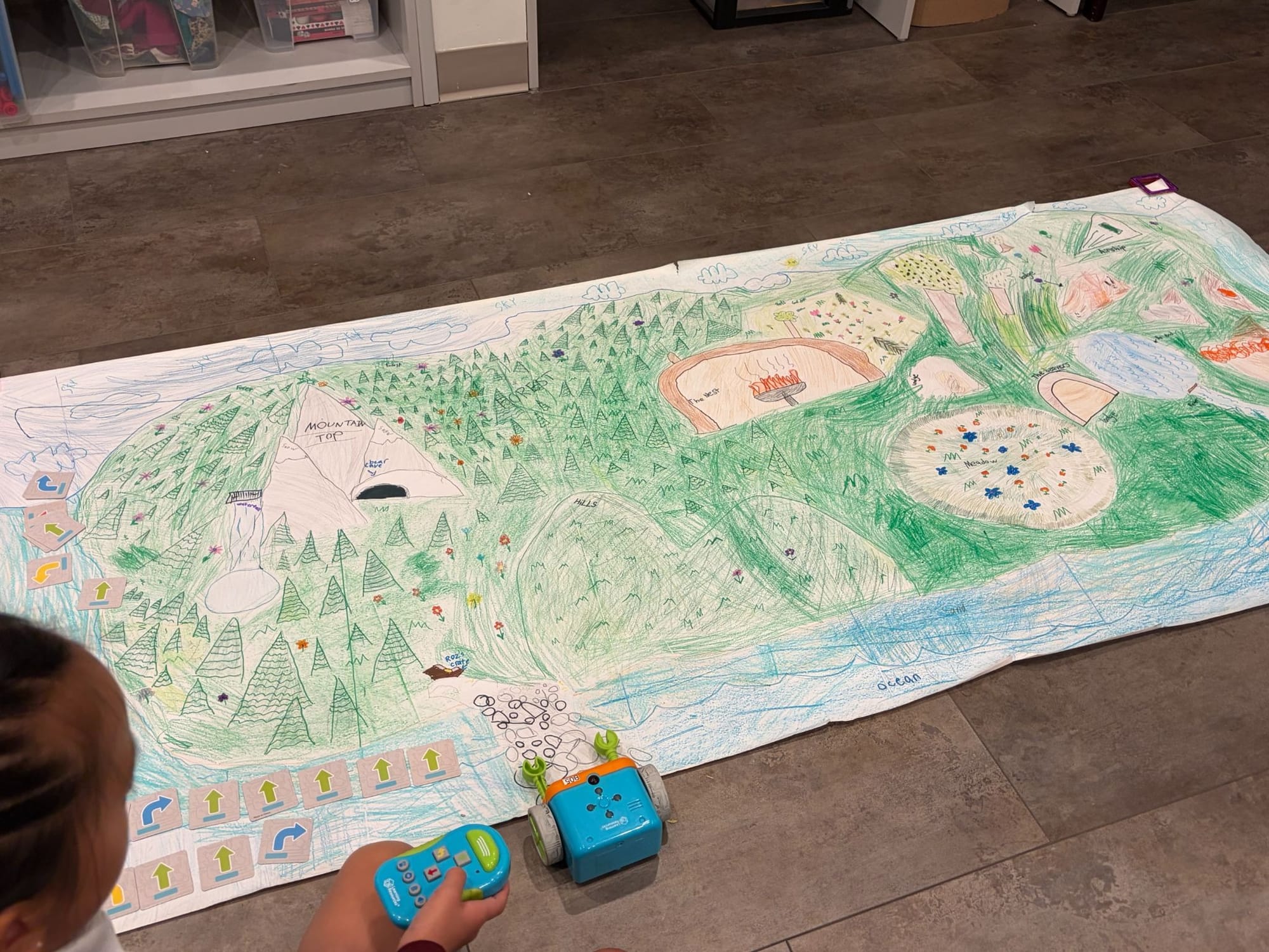
Combining what they knew from descriptions in the novel, their new knowledge of BC landforms, and lots of imagination, Libby’s students created their own version of Roz's home island as large floor maps. Groups of students worked together to build their maps based on the story.
- Where would the river flow?
- Which areas would be forest?
- Where were the rocky cliffs?
The Science learning gave students some background information and a richer way to visualize the setting. So they weren’t inventing the island from scratch. Instead, they used clues and descriptions from the novel to interpret where landforms and features belonged.
With the maps underway, it was time to introduce a new challenge: navigating the island with our own set of robots!
Introducing the Botleys 🤖
Botleys are screen-free educational robots designed to introduce students to the fundamentals of coding. Last year, Libby and I taught her previous class to program geometric shapes. This time, we wanted to send the Botleys on a mission to retell parts of Roz’s story.
 Jen
Jen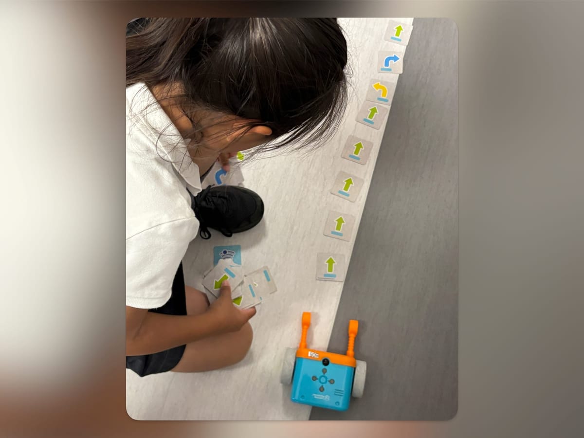
More Botley Stories!
Before handing students a robot and hoping for the best, we started with an unplugged coding exercise. I became the “human robot,” following students’ instructions to carry a crumpled paper ball to the recycling bin. It didn’t take long for them to discover that robots are wonderfully literal. If an instruction was vague, the robot did exactly what was asked, and not necessarily what was intended.
With the basics out of the way, the students spent the next week wrapping up the novel and finishing the details of their maps.
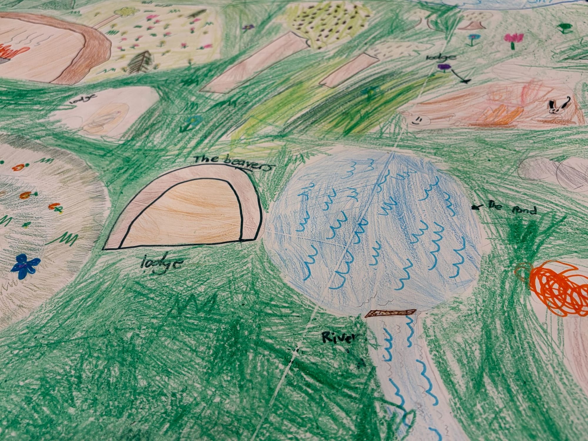
Students drew forests, meadows, beaches, mountains, and rivers. They sketched memorable locations from the novel such as the beaver pond, the goose nest, the coastline and cliffs, forests and mountains. They transformed a blank roll of paper into a landscape built from their science knowledge, story elements, and of course, their imagination!
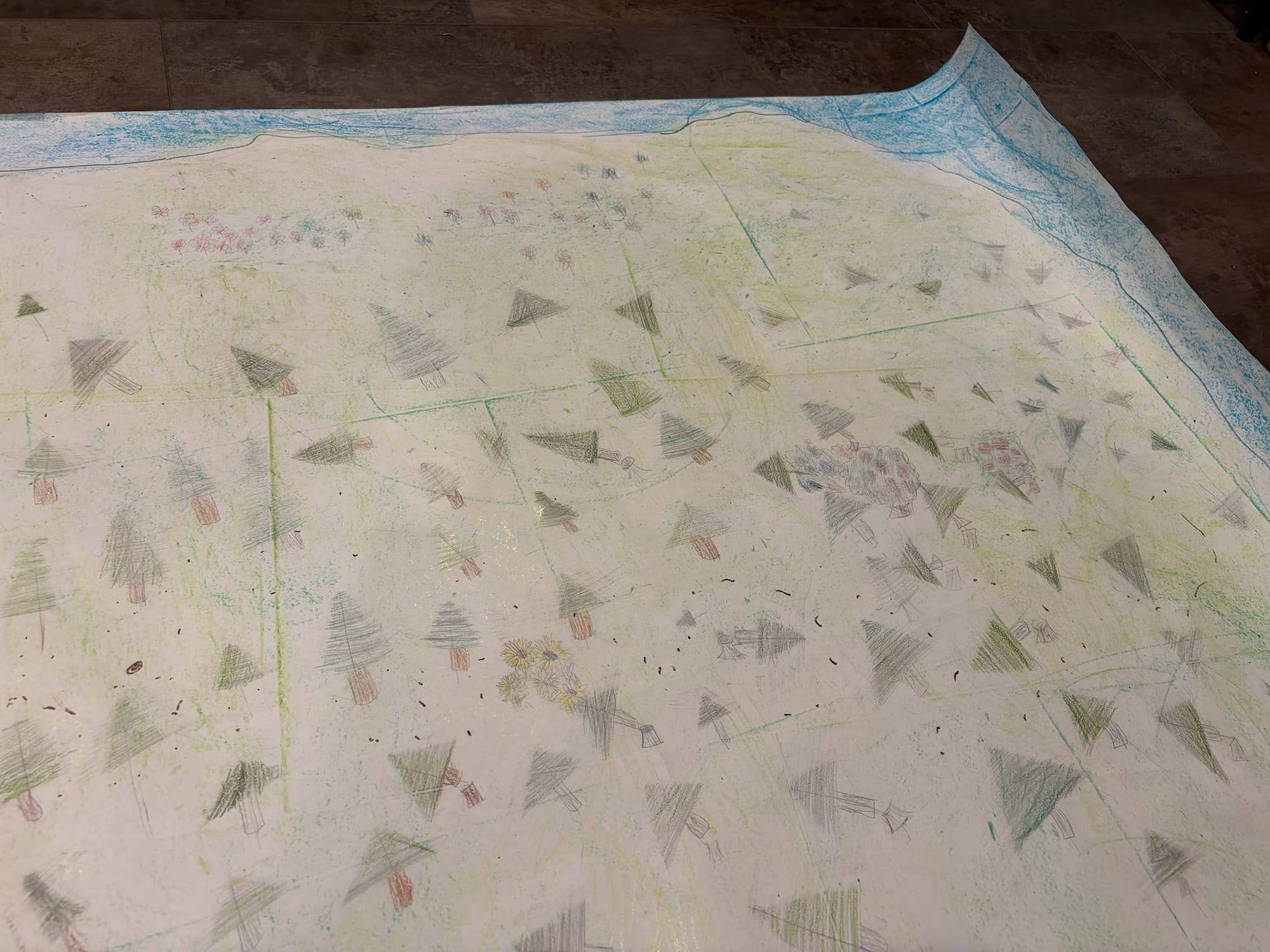
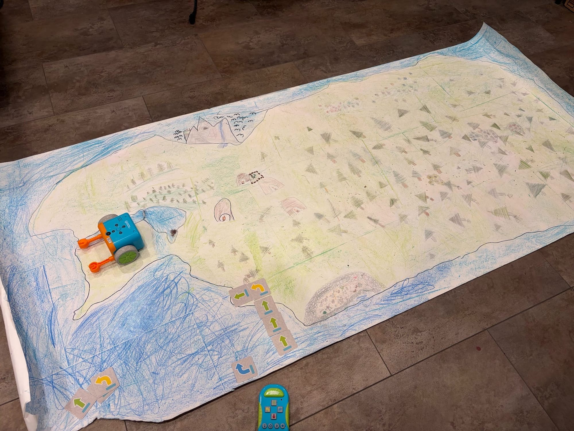
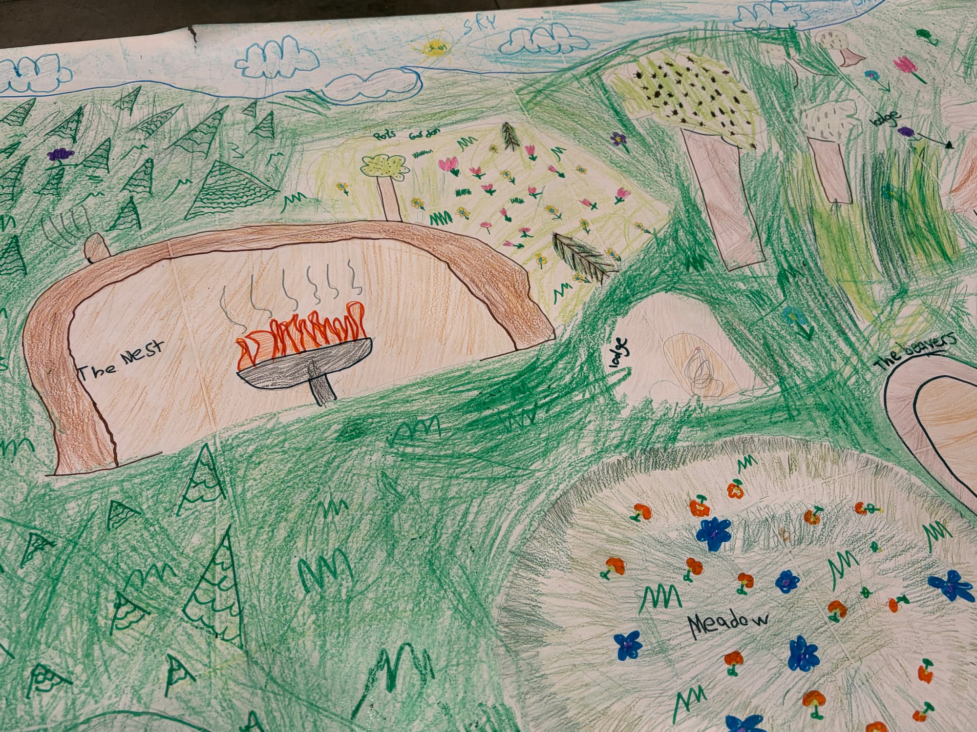
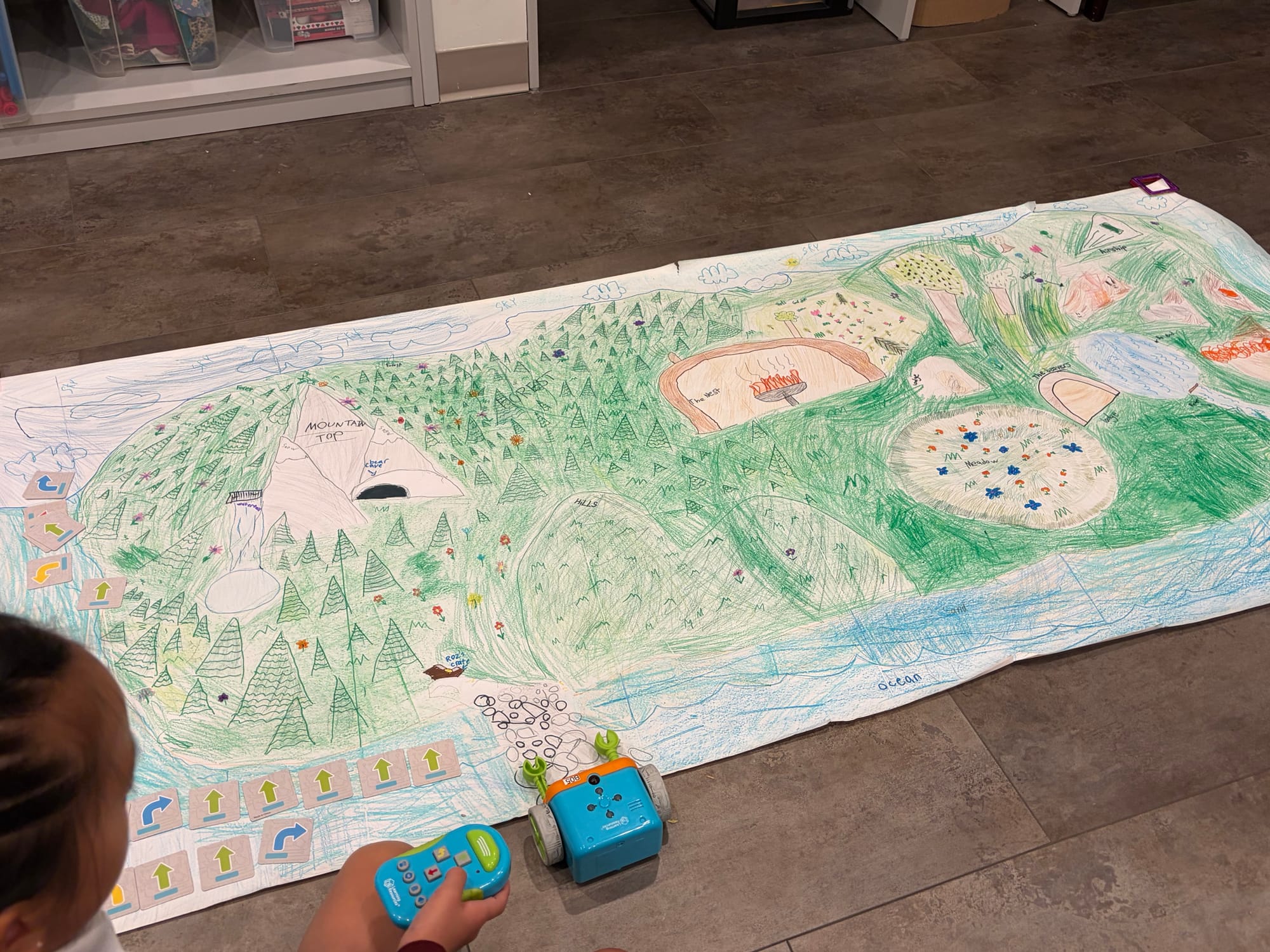
Students added landform details from descriptions in the book.
The Robot's Journey 📍
On my next visit, students worked with partners to program their Botley to travel across their maps. It was important that the robot wasn’t going on a random sequence of commands, but that the students retraced parts of Roz’s journey, stopping at significant locations to explain what happened there and why that place mattered in the story.
To capture their thinking, students recorded their Botley journeys in Seesaw. As the robot travelled from one location to the next, students explained each stop, naming the landforms and why those locations were significant to Roz’s story. Their recordings became a digital portfolio of both their coding and their understanding of the novel.
By the end of the project, students weren’t just recalling landform vocabulary or summarizing chapters from the novel. Blending Science, Language Arts, Art, and coding, students discovered that understanding a landscape can deepen understanding of a story’s setting, and a great story can make scientific ideas easier to remember.